

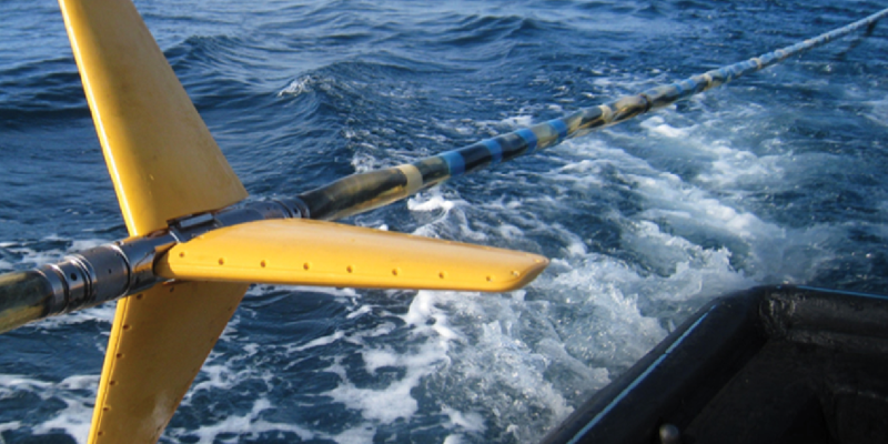
- Deep towing reduces weather impact and improves acquisition efficiency
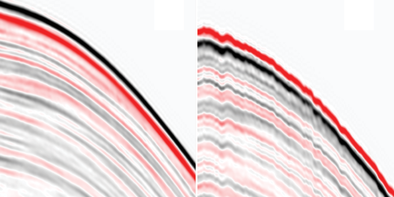
- Recorded signal is insensitive to variations in towing depth or local sea-surface variations, significantly reducing non-repeatable noise on reservoir monitoring projects
- Pre-stack amplitude and phase are consistent in an angle-dependent and frequency-dependent manner
- Rich low-frequency signal enhances Full Waveform Inversion (FWI) and improves the accuracy of subsurface property prediction
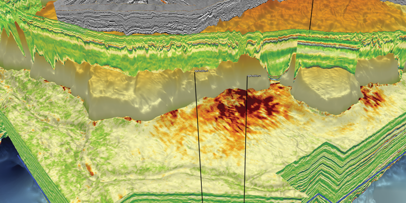
- Multisensor wavefield separation enables better shallow illumination. Near-surface images unaffected by acquisition footprint effects can be used for standalone interpretation
- Enhanced broadband resolution of stratigraphy assists the recovery of small time-shifts related to changes in reservoir saturation and pressure during reservoir monitoring projects
Accurate Characterization of the Subsurface
Broadband data acquired with GeoStreamer multisensor technology is perfect for high-fidelity reservoir monitoring and imaging at all target depths.
GeoStreamer uses both hydrophones and velocity sensors to remove all free-surface ghost reflections from marine seismic data. The streamer is towed deep, with a low-drag depth profile to minimize exposure to weather and surface noise. Data is rich in both low- and high-frequency signal, and ideal for high-fidelity reservoir monitoring, broadband imaging at all target depths, and the recovery of accurate geological properties during reservoir characterization.
Contact a PGS expert
If you have a question related to our Marine Acquisition services or would like to request a quotation, please get in touch.